File:Map PilcomayoBasin.jpg
No higher resolution available.
Map_PilcomayoBasin.jpg (595 × 420 pixels, file size: 49 KB, MIME type: image/jpeg)
Summary
[edit | edit source]
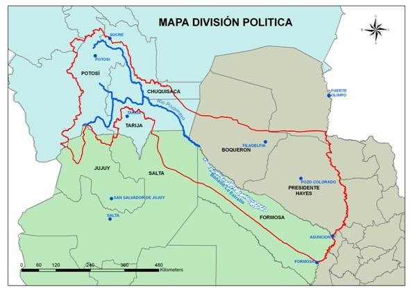
Map of the Pilcomayo River Basin, delineating the watershed and the area that belongs to the three riparian countries. The map also shows how the river, which used to constitute the border between Argentina and Paraguay, ends about half way before reaching the Parana at Asuncion and forms extensive wetlands called the Banada la Estrella. Source: http://www.pilcomayo.net/marcoreferencia-7
Licensing
[edit | edit source]
This file is considered to be in the public domain. See the file description for any additional details.
File history
Click on a date/time to view the file as it appeared at that time.
| Date/Time | Thumbnail | Dimensions | User | Comment | |
|---|---|---|---|---|---|
| current | 01:32, 26 May 2017 | | 595 × 420 (49 KB) | Julian Kölbel (talk | contribs) |
You cannot overwrite this file.
File usage
The following page uses this file: